
Kabul Is Facing More Than One Environmental Threat: New Research Maps the Overlap
A scientific assessment maps the overlap of flooding, heat, drought, soil erosion, and groundwater stress across Kabul. More than 80% of the study area is exposed to at least three hazards, while 2.8% faces all five.
The study provides a hazard baseline rather than a disaster forecast. It highlights the connections among groundwater decline, urban growth, heat, vegetation, and water security, while noting that population exposure, socioeconomic vulnerability, and adaptive capacity are also needed to assess human impacts.
Kabul is facing a more complicated environmental challenge than any single flood, drought, or heat event can explain. A new scientific assessment has mapped how several environmental hazards overlap across the Afghan capital, offering a different way to think about the city’s future risks.
Published in Environmental Management on September 3, 2026, the study examines five hazards: flooding, heat, drought, soil erosion, and groundwater stress. Researchers used geospatial analysis and multiple environmental indicators to identify areas where these pressures converge.

A City Where Risks Overlap
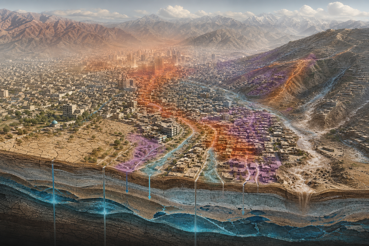
The study found that more than 80% of the study area is exposed to at least three hazards. About 44.3% is affected by three hazards, 32.9% by four hazards, and 2.8% by all five hazards examined.

That does not mean these hazards will necessarily occur at the same time. Instead, the map identifies places where several forms of environmental vulnerability exist together.
This distinction matters. A city can prepare for flooding, water shortages, or extreme heat separately, but the challenge becomes much harder when the same neighborhoods are exposed to several pressures at once.

Water Stress Is Part of the Bigger Picture
Groundwater is one of the central concerns identified by the research. Kabul relies heavily on groundwater, while parts of the city have experienced substantial declines in groundwater levels.
The study also identifies combinations involving groundwater stress, heat, soil erosion, and drought, showing that water security cannot easily be separated from the wider environmental condition of the city.
Heat and Urban Growth
Heat is another important part of the picture.
Built-up areas with limited vegetation can experience stronger heat exposure. As Kabul continues to develop, the relationship between urban expansion, vegetation, water availability, and local temperatures becomes increasingly important for long-term planning.
The research therefore raises a question that goes beyond environmental science: Can Kabul’s future growth be planned around multiple risks instead of responding to each problem after it becomes a crisis?
What the Research Does — and Does Not — Tell Us
The study provides a hazard baseline, not a prediction of exactly where future disasters will occur.
The researchers note that a complete assessment of risk would also need information about population exposure, socioeconomic vulnerability, and the ability of communities to adapt.
That limitation is important because a highly exposed area is not automatically the area that will experience the greatest human impact.
A Different Map for Kabul’s Future
The most important contribution of the research may therefore be its change in perspective.
Instead of asking only which hazard is the biggest, planners can begin asking where several hazards intersect — and whether those areas should receive greater attention in infrastructure, water management, urban design, drainage, vegetation, and nature-based solutions.
For Kabul, the challenge is increasingly interconnected. The city does not have five separate environmental problems. It has places where several pressures meet.
That may be where future urban resilience efforts need to begin.